
Connect with us today to learn more about our industrial automation solutions—and how to commission them for your application.
Why Choose Air Pollution Detection Drones?
Air Pollution Detection Drones offer a closer view of pollution than a single fixed monitor can provide. They can sample air along streets, near industrial boundaries, or above fields after a dust event. A small sensor payload may record particulate matter, gases, temperature, and humidity. Together, these readings can help teams spot local patterns and decide where ground checks are needed. The value is practical: measurements arrive from places that are difficult or costly to monitor continuously.
The equipment is only part of the story. Sensor calibration, flight height, wind, and battery limits all affect what the data means. A drone reading is not automatically a complete picture of exposure, and different sensors may respond differently to moisture or nearby sources. Atmospheric scientist Dr. James Crawford, whose work includes airborne air-quality research, offers a relevant principle—paraphrased here, not presented as a direct quotation: “Useful pollution maps depend on trustworthy measurements gathered in the right place and time.” That distinction matters.
There are trade-offs. Short flights produce snapshots, not continuous records. Data also needs careful review before it supports public-health or operational decisions. Still, Air Pollution Detection Drones can add fine-grained observations to established monitoring networks, especially when teams compare their readings with calibrated ground instruments. The method is promising, but not magic. A sensor can miss what it was not designed to detect. Choosing a drone system therefore means weighing coverage, sensor quality, flight endurance, and the people who will interpret the results. That is the real question behind “Why Choose Air Pollution Detection Drones?”
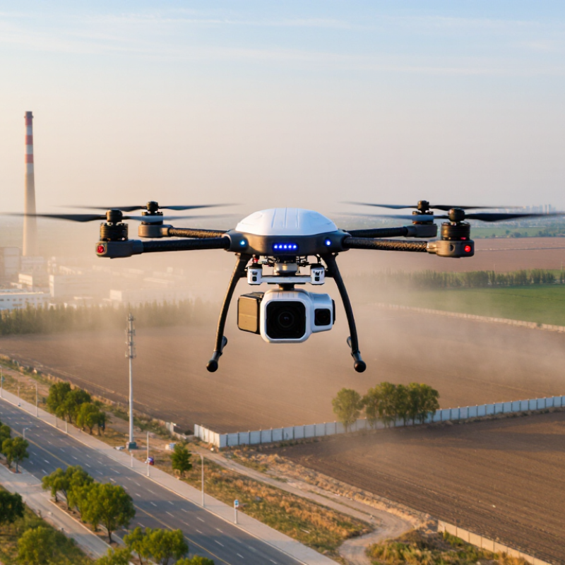
Table of Contents [Hide]
What Air Pollution Detection Drones Are and How They Work
Air pollution detection drones are aircraft fitted with sensors that measure pollutants while moving through the air. Depending on the equipment, they may monitor fine particles, ozone, or gases such as nitrogen dioxide. The drone also records its position and altitude, so each reading can be linked to a place and height.
Here is how a typical survey works. A trained operator plans a route and checks weather conditions before flight. Air passes through an inlet to the sensors, which estimate pollutant levels at regular intervals. GPS data, timestamps, and sometimes wind measurements help researchers interpret the results. On a map, readings can reveal how pollution changes near a road, above a work site, or across different heights. Small details matter.
These measurements are useful, but they are not automatically precise. Rotor airflow can disturb samples, and humidity or sensor response time may affect readings. Careful calibration and comparison with trusted ground monitors help identify errors. A drone shows a moving snapshot, not a complete picture of long-term exposure. That distinction is easy to overlook. Even a well-planned flight may need repeating under different conditions.
| Data Dimension | How It Works | What It Measures or Provides | Practical Considerations |
|---|---|---|---|
| Air pollution detection drone | An unmanned aircraft carries air-quality sensors and records measurements along a planned flight route. | Pollutant readings associated with location, time, and—when recorded—altitude. | It complements fixed monitors and ground sampling; it does not automatically replace regulatory monitoring stations. |
| Particulate matter (PM2.5 and PM10) | Many compact sensors estimate particle concentration by measuring how particles scatter light inside a sensing chamber. | Estimated concentrations of fine particles (PM2.5) and inhalable particles (PM10), commonly reported in µg/m³. | Readings can be affected by humidity, particle composition, and sensor design. Optical estimates may need comparison with reference instruments. |
| Gaseous pollutants | Depending on the instrument, electrochemical, optical, or other gas sensors detect specific gases in sampled air. | Potential targets include ozone (O3), nitrogen dioxide (NO2), carbon monoxide (CO), and sulfur dioxide (SO2); results are often expressed in ppb or ppm. | Each sensor has its own detection range, response time, and possible cross-sensitivity. The drone payload must be selected for the target gases. |
| Carbon dioxide (CO2) | A compact nondispersive infrared (NDIR) sensor estimates CO2 by measuring absorption of infrared light. | CO2 concentration, typically reported in ppm; useful for studying ventilation or localized emissions when interpreted in context. | CO2 is not a direct measure of overall air quality. Background levels, wind, and nearby sources affect interpretation. |
| Location, time, and altitude | Navigation data and sensor timestamps are combined with pollutant readings during logging or post-processing. | Georeferenced measurements and, when available, vertical profiles showing how concentrations vary with height. | Position and altitude accuracy depend on the aircraft, navigation equipment, and flight conditions. Sensor and navigation clocks should be synchronized. |
| Air sampling and sensor placement | Air reaches the sensor through natural airflow or a pump, depending on the payload design; the sensor converts its response into a recorded reading. | A sequence of measurements collected while the drone follows a route or holds at selected locations. | Propeller airflow, vibration, heat, and the sensor’s response time can influence readings. Placement and flight speed should be considered during testing. |
| Typical mission duration | Battery-powered multirotor drones collect data during a planned flight and return for landing or battery replacement. | A single sortie provides a time-limited survey; repeated flights can help compare locations or conditions. | Flight time varies substantially with aircraft, payload, battery, wind, and operating conditions. Payload weight and safety reserves reduce usable survey time. |
| Data quality and validation | Operators calibrate or check sensors, log relevant conditions, and compare results with suitable reference measurements where possible. | Quality-checked readings that can reveal spatial patterns and support follow-up investigation. | Low-cost sensors can be useful for screening and mapping, but their uncertainty and limitations should be reported; results are not automatically regulatory-grade. |
| Suitable applications | A planned route samples selected locations, heights, or times that are difficult to cover with a stationary instrument alone. | Examples include localized pollution surveys, vertical profiling, industrial-site screening, and research into changing air-quality patterns. | Findings depend on sensor capability, sampling design, weather, and access. A drone survey identifies patterns but does not by itself prove a source or cause. |
| Safety and operating rules | A trained operator plans the flight, checks the aircraft and surroundings, and follows applicable aviation requirements. | A controlled survey that accounts for people, structures, airspace, and environmental conditions. | Requirements vary by jurisdiction and operation. Airspace restrictions, permissions, privacy, weather, and safe separation must be assessed before flight. |